
Page 26 - Curriculum Visions Dynamic Book. To close the book, close the tab.
P. 26
Isohyet
Isohyet
A line drawn on a weather chart (see: Synoptic chart) to represent places having the same amount of rainfall.
Isotherm
A line on a weather chart (see: Synoptic chart) that joins places with the same temperature.
J
Jet stream
A tunnel of fast-moving air that normally forms where two different kinds of air meet high in the atmosphere. There are two jet streams in each hemisphere, one near the Arctic or Antarctic Circle (called the polar jet stream), the other close to the tropics (called the subtropical jet stream).
K
Khamsin
A hot, dry wind that blows from the Sahara Desert to Egypt. It
is known as rih al khamsin (‘the wind of 50 days’) in North Africa and the Arabian Peninsular, an indication of how long it lasts. (Khamsin is the Arabic word
for 50.)
L
Land breeze
A breeze that blows off the land towards the sea. Land breezes are common when nice, sunny, settled weather occurs during the night, when the land has cooled down more than the nearby sea. Air rises over the sea, drawing cooler air off
the land. It is the opposite of a sea breeze.
Latitude
The distance north and south of the equator measured in degrees and often shown on maps as a line. The equator is at 0°, the North Pole is 90°N and the South Pole is 90°S.
Latitudes are also used to mean the bands of similar weather that occur at certain distances between the equator and the poles (for example, mid-latitudes).
Layer cloud
Clouds that are formed by the bulk upwards movement of moist air. This happens when air moves up over cold air at a front and also on the windward side of a mountain. Layer clouds are always of the stratus type.
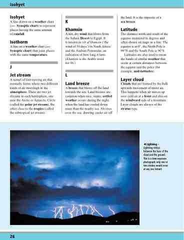
Lightning – Lightning strikes between the base of the cloud and the ground. This is a time-exposure photograph; only one or two strokes would occur at any one instant.
26
