
Page 29 - Curriculum Visions Dynamic Book. To close the book, close the window or tab.
P. 29
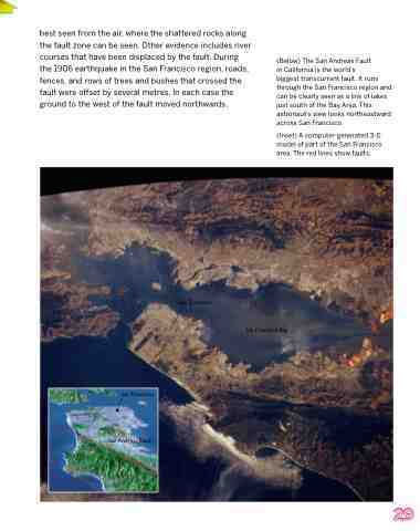
best seen from the air, where the shattered rocks along the fault zone can be seen. Other evidence includes river courses that have been displaced by the fault. During the 1906 earthquake in the San Francisco region, roads, fences, and rows of trees and bushes that crossed the fault were offset by several metres. In each case the ground to the west of the fault moved northwards.
(Below) The San Andreas Fault
in California is the world’s
biggest transcurrent fault. It runs through the San Francisco region and can be clearly seen as a line of lakes just south of the Bay Area. This astronaut’s view looks northeastward across San Francisco.
(Inset) A computer-generated 3-D model of part of the San Francisco area. The red lines show faults.
San Francisco
San Francisco Bay
San Francisco
San Andreas Fault
29
